Quote from the Statesman Journal Jan. 11th reporting on the "Big Look" task force regarding land use law:
"Rep. Brian Clem, a Salem Democrat, will head the House Committee on Agriculture, Natural Resources and Rural Communities. Clem said his committee is unlikely to take up the major land-use bills originated by the task force, but may work on revisions to what uses are allowed in exclusive-farm-use zones. Contrary to its name, the zones allow a myriad of uses not directly related to farming."
http://www.statesmanjournal.com/article/20090111/LEGISLATURE/901110343
Our group has been apprised that one revision will be to limit utilities such as 500 kV lines in EFU zones, thus sparing other farm communities from the misery we have been through.
Friday, January 30, 2009
February NEPA meeting rescheduled
Malheur County Planner Jon Beal sent along this message:
The BLM meeting for the cooperating agencies involved in the NEPA project scheduled for Feb. 3 and 4 has been cancelled. There have been several other public agencies including the Owyhee Irrigation District, Canyon County and Parma who have requested to be included as cooperating agencies in the NEPA process for the environmental impact report.The BLM wants to have the new agencies brought up to speed before the meeting. It is tentatively scheduled for March 9.
February 9th FRCC Meeting
The next general Stop Idaho Power meeting will be held at the Four Rivers Cultural Center in Ontario Monday, February 9th at 7:00 p.m. Everyone is invited.
A lot has happened since our last meeting, so the agenda will cover:
1) The Dalles EFSC meeting report by Bruce Corn
2) Baker City update and Idaho Power IRP Advisory by Roger Findley
3) Homedale and Parma updates by Bruce Penn
4) Ontario FRCC NEPA county and state meeting UPDATE This meeting has been rescheduled for March 9 (see blog post above) so will be taken off the agenda
5) Evaluation of ODOE's Project Order
6) Strategy Plan for what happens next
We are especially looking for personal, documented stories on health problems that may be encountered by living or working around or caring for animals near 500 kV transmission lines, or if you have a business such as recreational golf or remote control planes or crop dusting or radio that will be affected, please write your story up and bring it to send to the ODOE. We also need documentation for property owners who are providing wildlife habitat through the ODFW, and any documented cultural or historical artifacts that may have been found on your property.
We will be ordering more No Entry signs since other groups are also interested in posting them. Evelyn Sayers is working on a No Consent form as a reply to Idaho Power's easement and right-of-way Consent letters (now they are sending them Certified Mail!) which are lacking any option to say NO.
We are looking forward with interest to IPCo's Eric Hackett's promise of new corridor routes to appear in late February.
Thursday, January 29, 2009
Idaho Power IRP Advisory Feb. 3rd
Idaho Power's Integrated Resource Plan Advisory Council Meeting is scheduled for Tuesday, February 3rd, from 10 a.m. - 3 p.m. at Idaho Power's corporate headquarters, 1221 W. Idaho St., Boise, ID 83702.
From Idaho Power's website:
The Integrated Resource Plan (IRP) is a comprehensive look at present and future demands for electricity, as well as a plan for meeting those demands. . .
Idaho Power enlists the assistance of its customers in developing the IRP through an advisory council. The council’s responsibilities include:
- Representing the interests of Idaho Power’s more than 480,000 customers
- Participating in open and active discussions of relevant issues, and
- Working with Idaho Power to develop ways to engage the public-at-large in the IRP process.
. . . The 2006 IRP previewed the company's load and resource situation for the next 20 years, analyzed potential supply-side and demand-side options and identified near-term and long-term actions . . .
http://www.idahopower.com/energycenter/irp/2006/
Idaho Power's Integrated Resource Plan is associated with the 25-year Treasure Valley Electrical Plan (TVEP), of which the 500 kV transmission lines are a part. Tuesday's IRP Advisory Meeting is open to the public, so seven members of the Stop Idaho Power Board of Directors will be in attendance to give public comment. We encourage any interested parties from Canyon, Payette or Owyhee counties to also be in attendance.
Project Order Issued
Contents of the cover letter to the B2H Project Order:
http://boardmantohemingway.com/documents/B2H_Cover%20for%20project%20order.pdf
January 26, 2009
Mr. Eric Hackett
Idaho Power Corp.
P.O.Box 70
Boise, Idaho 83707
Dear Eric,
Attached is the Project Order for the proposed Boardman to Hemingway transmission line. The project order is based on the Notice of Intent (NOI) that Idaho Power submitted to the Oregon Department of Energy on August 28, 2009. It reflects comments made by state agencies and the commissions of all five Oregon counties affected by the proposed project.
The project order also reflects the comments on the NOI made by the public at the joint public information meetings that were held in October 2008, received through the project website, or sent directly to the Department by email or US mail.
Although the Project Order is a long document, there are key points that ODOE wants to emphasize. These issues were raised repeatedly in public and agency comments, particularly from the commissioners of the five Oregon counties. Many of these issues relate directly to the proposed project’s ability to comply with the rules of EFSC, other state agencies and local governments. These issues must be addressed adequately in the Application for Site Certificate in order for ODOE to find the application complete. This could mean providing mitigation, but it could also mean modifying the route to avoid the impact. In particular, the application must address the following:
Impact on land in the Oregon Exclusive Farm Use Zone:
ODOE is particularly concerned about the many public and agency comments stating that Idaho Power must do more to avoid land in Oregon zoned Exclusive Farm Use (EFU). Much of the route described in the NOI is located in the EFU zone. Oregon land use law strongly protects EFU land, and allows its use only if alternatives were seriously considered and were shown not to be feasible according to criteria prescribed in the statute. Idaho Power must seriously consider route alternatives through other lands before using the EFU zone in Oregon. This includes alternatives that bypass part of Oregon by using a more direct route through Idaho.
If the line must be sited in the EFU zone, Idaho Power must demonstrate compatibility with the prevailing farm use and with practices such as irrigation and pest and weed control.
Use of Federal Land
Many residents and elected officials expressed concern about the large use of private land, compared to the much smaller use of BLM or US Forest Service land. ODOE recognizes that only those federal agencies have the authority to grant right of way on the lands that they manage, subject to the federal regulations and state and federal mitigation requirements.
However, EFSC must consider the impact on private lands as well as public lands. ODOE expects Idaho Power to work with BLM on route alternatives that minimize impact on private land, particularly farm land, even if that means requesting additional right of way from the federal agencies. If Idaho Power cannot avoid private land by seeking right of way on federal land, then that prohibition must be based on applicable federal regulations and must be documented by the federal agencies.
Habitat Impacts on Private Land
Many of the comments on the NOI documented habitat values on private land. For example, some property owners have managed their property for habitat value under agreements with ODFW or federal agencies.
The EFSC habitat standard is based on habitat value, regardless of whether the land is public or private. High category (category 1 or 2) habitat on private land is afforded the same protection under EFSC standards as similar category public land. Comments from resource agencies have focused largely on the sage grouse, but ODFW has also noted that Big Game Range is considered Habitat Category 2.
Consideration of Alternate Routes
Many comments included alternate route suggestions. Some suggestions were short detours along the route described in the NOI, and others involve a major reroute.
EFSC expects Idaho Power to seriously consider alternate routes that are feasible and would reduce impact on private land. This may involve changing the proposed route and examining routes that were not previously considered. We understand that this will take more effort and more time, and could cause the application to be submitted at a later date than originally projected. However, this step is necessary for the Council to find that the project minimizes adverse impacts on the resources protected by its standards.
ODOE would like to discuss the contents of this Project Order with you in detail and in person. Please contact the Project Officer, Adam Bless, or the Siting Manager, Tom Stoops to arrange a date when we can go over this order in detail. As always, feel free to contact ODOE at any time. We would like to thank Idaho Power for the high level of outreach and consultation with reviewing agencies, local county governments and other stakeholders to date. We look forward to working with you in reviewing a proposal for the transmission line that meets the company’s needs and is acceptable to the many stakeholders along the route.
Sincerely,
Adam Bless
Oregon Department of Energy
625 Marion St. NESalem, OR 97301-3737Phone: (503) 378-4040Toll Free: 1-800-221-8035FAX: (503) 373-7806www.Oregon.gov/ENERGY
The entire 31-page pdf document can be found here: http://boardmantohemingway.com/documents/B2H_Project_Order_rev%200%20issued%20_3_.pdf
Move Idaho Power Baker County
Baker County has a great new blog called Move Idaho Power Baker County, maintained by Curtis Martin of North Powder. Check it out at:
http://www.moveidahopower.com/
Good luck, Baker!
An article in the Baker City Herald covering their Jan. 22 meeting can be found at:
http://www.bakercityherald.com/Local-News/Crowd-seeks-best-power-line-route
http://www.moveidahopower.com/
Good luck, Baker!
An article in the Baker City Herald covering their Jan. 22 meeting can be found at:
http://www.bakercityherald.com/Local-News/Crowd-seeks-best-power-line-route
Wednesday, January 28, 2009
Letter to Oregonian
Dear Mr. Cockle, Oregonian Newspaper
Attached is a letter I sent to Idaho Power and the Oregon Energy Facilities Siting Council (EFSC) regarding Malheur County's concerns regarding the presently proposed routes for the B2H transmission line. (posted earlier on this blog)
The residents of Malheur County are not opposed to the construction of the transmission line. They are opposed to the proposed routes through some of the best and most productive agricultural land in the state. The majority of the proposed route in Malheur County is located on capability class I through III soils, much classed as prime or high value soils by the Oegon Department of Agriculture. Location of the transmission line on intensively farmed land will have a negative effect on the operation of farms. It will require changes and increases the cost in the manner in which the lands are irrigated, tilled and the application of chemicals. We are requesting routes on open range land and federal lands be considered which would have considerably less negative effect on farmland in Malheur County.
Malheur County is not benefitted by the location of the transmission line within its borders. It does not open the area to the placement of industries or produce any long term jobs for the area. One of the main reasons for the transmission line is to provide power for the Boise Valley which because of Idaho's lack of an organized land use program has become a poster child for urban sprawl. A committee composed entirely of Idaho residents recommended the line be placed in Oregon because it is not "developed" like Idaho. The reason Malheur County is not "developed" like the Boise Valley is because of Oregon's land use program and the restrictions on rural development coming from Statewide Land Use Planning Goal 3, Agricultural Lands. Idaho Power has chosen, pursuant to the applicable OAR, to have land use issues in Malheur County regarding placement of the transmission line decided by the EFSC instead of the Malheur County planning commission and county governing body.
Many of the residents of Malheur County feel the state's land use program and the restrictions on rural development are the reasons Malheur County is one of the poorest counties in Oregon. Agriculture is our life line in Malheur County and we have worked hard over the last 30 years to protect our best and most productive farmland from non farm development. Pursuant to state law a transmission line is an allowed outright permitted non farm use on farmland and Malheur County is not being allowed to make the land use decisions regarding it. Many feel the land use program we have used to protect our agricultural land from non farm uses is now being used against us in determining the placement of the B2H transmission line.
EFSC must consider Malheur County's land use regulaltions when deciding the land use issues. Policies contained in the county comprehensive plan create a hierarchy of site preference to soils with a lower capability classification for non farm uses in our agricultural zones. They also require normal farming and ranching practices be allowed to exist and continue without interference from non farm uses. Malheur County contends the requirements of state statute require Idaho Power and EFSC to consider alternative routes on open range land and federal lands to minimize the impact on the county's best and most productive land. The Hemingway-Sand Hollow direct route located entirely in Idaho is also a valid alternative to locating the route on agricultural lands in Oregon and should also be considered.
Come over to Malheur County and let us show you where Idaho Power is proposing to place the transmission line. Speak with some of the farmers who will be impacted by the proposed location of the line in their farm operations and let us show you where we feel it should be located. You will see the residents of Malheur County are not opposed to the construction of the transmission line, however, they are very much opposed to a very bad route that will have that will negatively effect the main industry in the county, farming.
Jon D. Beal, Malheur County Planning Director
Monday, January 26, 2009
Application for a Site Certificate
If you've been following this blog, you'll know that the Oregon Department of Energy is now writing a Project Order regarding Idaho Power's Notice of Intent to build the B2H transmission line. The Project Order makes relevant regulatory applications to the NOI and will require IP to address these regulations in order to qualify for a Site Certificate.
OAR 345-021-0010 Contents of an Application
(1) The project order described in OAR 345-015-0160(1) identifies the provisions of this rule applicable to the application for the proposed facility, including any appropriate modifications to applicable provisions of this rule. The applicant shall include in its application for a site certificate information that addresses each provision of this rule identified in the project order . . .
(III)(D) If the proposed energy facility is a pipeline or a transmission line or has, as a related or supporting facility, a transmission line or pipeline that, by itself, is an energy facility under the definition in ORS 469.300, a corridor selection assessment explaining how the applicant selected the corridor(s) for analysis in the application. In the assessment, the applicant shall evaluate the corridor adjustments the Department has described in the project order, if any. The applicant may select any corridor for analysis in the application and may select more than one corridor. However, if the applicant selects a new corridor, then the applicant must explain why the applicant did not present the new corridor for comment at an informational meeting under OAR 345-015-0130. In the assessment, the applicant shall discuss the reasons for selecting the corridor(s), based upon evaluation of the following factors:
(i) Least disturbance to streams, rivers and wetlands during construction;
(ii) Least percentage of the total length of the pipeline or transmission line that would be located within areas of Habitat Category 1, as described by the Oregon Department of Fish and Wildlife;
(iii) Greatest percentage of the total length of the pipeline or transmission line that would be located within or adjacent to public roads, as defined in ORS 368.001, and existing pipeline or transmission line rights-of-way;
(iv) Least percentage of the total length of the pipeline or transmission line that would be located within lands that require zone changes, variances or exceptions;
(v) Least percentage of the total length of the pipeline or transmission line that would be located in a protected area as described in OAR 345-022-0040;
(vi) Least disturbance to areas where historical, cultural or archaeological resources are likely to exist; and
(vii) Greatest percentage of the total length of the pipeline or transmission line that would be located to avoid seismic, geological and soils hazards;
(viii) Least percentage of the total length of the pipeline or transmission line that would be located within lands zoned for exclusive farm use;
(E) For any pipeline or transmission line, regardless of size:
(i) The length of the pipeline or transmission line.
(ii) The proposed right-of-way width of the pipeline or transmission line, including to what extent new right-of-way will be required or existing right-of-way will be widened.
(iii) If the proposed corridor follows or includes public right-of-way, a description of where the facility would be located within the public right-of-way, to the extent known. If the applicant proposes to locate all or part of a pipeline or transmission line adjacent to but not within the public right-of-way, describe the reasons for locating the facility outside the public right-of-way. The applicant must include a set of clear and objective criteria and a description of the type of evidence that would support locating the facility outside the public right-of-way, based on those criteria.
(At last, we'll know the answer to these questions!)
https://portal.sos.state.or.us/division/archives/rules/OARs_300/OAR_345/345_021.html
Newspaper Articles
Recent newspaper articles you might find interesting.
UPDATE
The Bend Bulletin, http://www.bendbulletin.com/ (this article by subscription only) concludes in its Jan. 27th editorial opinion, "Don't kill the lights on power plan," that "Oregonians who want reliable power, more renewable power and reasonable rates must understand that projects like these are necessary." (italics added)
One of many uninformed opinions by people on the other side of the state who like to lecture us so we'll be as smart as they are.
This after it asks the $64,000 question, "People have also asked why the proposal travels so far through private land rather than detouring through public land owned by the Bureau of Land Management," and then fails to answer it, instead handing us that pedantic reply that "No matter what final route is chosen, people are going to be unhappy."
At least one reader gets it, saying in the comment section:
'I saw nothing in the article questioning the need for this project. It seems the people understand "projects like these are necessary". What is not answered is the question why so many landowners will be impacted versus BLM? Sounds like a pretty simple question to factually answer. But no, let us not provide any answers to that let's just say; Shut up and sit down. It is for your own good and we know better. Perhaps the bad weather is affecting your capability to provide news so we get another editorial of questionable value.'
The Capital Press (western agriculture) article on SIP:
http://www.capitalpress.info/main.asp?Search=1&ArticleID=48110&SectionID=67&SubSectionID=617&S=1
The Owyhee Avalanche website dedicated to the B2H project, including maps:
http://owyhee.com/B2H/B2Hindex.html
Owyhee Avalanche articles:
http://owyhee.com/B2H/Articles.html
The Oregonian's Richard Cockle has a recent article quoting IP's Eric Hackett and Malheur County's Lynn Jensen and Stacie ("Traci") Trenkel:
http://www.oregonlive.com/news/index.ssf/2009/01/critics_blast_proposed_eastern.html
Although Cockle tries to be evenhanded here, it isn't the intention of Stop Idaho Power to "pull the plug" on the transmission line, only to route it away from prime farmland and onto designated utility corridors. Hackett is again quoted making the statement that the "route decisions 'were purely resource driven.' The utility's engineers, he said, 'had no idea what was federal, private or state land' when the corridor was laid out.' "
Anyone inspecting the maps would have to scratch their heads in bafflement, since you'd think with Malheur County being 80-85% publicly owned land, that hitting private land nearly 100% of the time under IP's proposed route would be against all odds. Maybe we're just not smart enough to understand.
Saturday, January 24, 2009
Owyhee County Homedale Meeting
SIP's Idaho liaison Bruce Penn's report on the meeting:
1-22-09 B2H 500 kV Power Line
On Thursday, January 22, 2009 , SIP, represented by Roger Findley, Tom and Pat Phillips and myself, was invited to attend an Owyhee Co. community meeting in Homedale, ID. regarding the proposed Idaho Power transmission line routing. Roger gave his power point presentation and had a Q. & A. time with the folks in attendance. Malheur Co. Court was also represented by Judge Dan Joyce.
 Seated is Barney Harper, who conducted the meeting January 22nd in Homedale.
This was Owyhee Co.’s first public meeting regarding the power line and there was unofficially over 85 in attendance. They had a good cross section of residents present from a county commissioner, local area farmers, teachers, The Owyhee Avalanche (local newspaper), and business owners. The manager of the South Board was also in attendance and spoke to the group regarding his many concerns of impact this line will have on the irrigation system in this area.
This group is beginning to organize and build momentum to oppose the current proposed route. Like in Malheur Co., it is on private land. Subsequent public meetings have been set for Feb. 18 at Rimrock, Feb. 20 at Marsing and possibly in Grandview and Bruneau. They have many concerns and are troubled by IP’s course of action and public statements thus far regarding this power line. I’m not exaggerating to say many feel ‘ misled’ by IP at this point. A petition drive was started at the meeting.
There was discussion regarding SIP and its relationship with other impacted counties particularly in Idaho. The current relationship is one of mutual cooperation and support, sharing of information and communication with each other. Legal aspects is yet to be determined. Owyhee Co’s. consensus seems to be in agreement with SIP – move this line into public lands and where Owyhee county already has a utility corridor why has IP proposed a route through private land?
I exchanged email addresses and my cell phone number with key people and will work to keep both groups informed of each other’s meetings and activities. Also, in attendance was a resident of Canyon Co. with impacted property in Payette Co. He was in attendance at the Parma meeting held last week. He will work to talk with private land owners in both Payette and Canyon Counties. He and I will keep in contact.
Sincerely presented,
Bruce Penn
Friday, January 23, 2009
West Wide Energy Corridor Record of Decision
News Release
USDA Forest Service Washington, D.C.
FS-0902 Contact: Press Office 202-205-1134
ENERGY CORRIDORS IN THE ELEVEN WESTERN STATES DESIGNATED
Decision provides for increased protection of natural resources
WASHINGTON, Jan 14, 2009-- USDA Undersecretary Mark Rey has signed a Record of Decision (ROD) amending 38 National Forest Land Management Plans to identify locations of corridors suitable for future energy transmission infrastructure across Forest Service land. The corridors protect or minimize resource impacts to lands and surface resources by identifying preferred locations for corridors that also cross Federal lands managed by other agencies. These corridors offer the American public a way to meet the increasing energy demands while mitigating potential harmful effects to the environment.
 Federally designated energy corridors (I-84 and PP&L) (click for larger picture)
• States Involved. As required by Section 368(a) of the Energy Policy Act of 2005, this decision applies to National Forests located in Arizona, California, Colorado, Idaho, Montana, Nevada, Oregon, Utah, Washington and Wyoming.
• No Occupancy is Authorized by this Decision; this is a decision identifying the preferred locations of corridors. Future use requires compliance with National Environmental Policy Act and other relevant laws.
The Energy Policy Act of 2005 directs the Secretaries of Agriculture, Commerce, Defense, Energy, and the Interior to designate energy transport corridors for oil, gas, and hydrogen pipelines and electricity transmission and distribution facilities on Federal lands in portions of Arizona, California, Colorado, Idaho, Montana, Nevada, New Mexico, Oregon, Utah, Washington and Wyoming. The Act further directs that environmental reviews be completed for the designation of such corridors, and that the designated corridors are incorporated into the relevant agency land use and resource management plans or equivalent plans.
The Final Programmatic Environmental Impact Statement supporting this decision was published on November 28, 2008. The PEIS identifies 332,734 acres of NFS lands for Section 368 energy corridors. A separate decision by the Bureau of Land Management, National Park Service, Department of Defense, Fish and Wildlife Service or Bureau of Reclamation will be made, as appropriate for their lands.
This ROD does not affect existing pipeline or transmission authorizations. Furthermore, it does not authorize any ground disturbing activities. This ROD is the final decision of the Department of Agriculture and is not open to appeals under the regulations found at 36 CFR 219.13(a)2.
Copies of the Record of Decision and Final Environmental Impact Statement are available upon request from Forest Supervisor’s Offices in the eleven western states or the Washington Office of the Forest Service. These documents will also become available on the Project Web site at: http://corridoreis.anl.gov/.
The mission of the US Forest Service is to sustain the health, diversity, and productivity of the nation’s forests and grasslands to meet the needs of present and future generations. The agency manages 193 million acres of public land and is the largest forestry research organization in the world.
http://corridoreis.anl.gov/documents/docs/BLM_WWEC_ROD_press_release.pdf
USDA Forest Service Washington, D.C.
FS-0902 Contact: Press Office 202-205-1134
ENERGY CORRIDORS IN THE ELEVEN WESTERN STATES DESIGNATED
Decision provides for increased protection of natural resources
WASHINGTON, Jan 14, 2009-- USDA Undersecretary Mark Rey has signed a Record of Decision (ROD) amending 38 National Forest Land Management Plans to identify locations of corridors suitable for future energy transmission infrastructure across Forest Service land. The corridors protect or minimize resource impacts to lands and surface resources by identifying preferred locations for corridors that also cross Federal lands managed by other agencies. These corridors offer the American public a way to meet the increasing energy demands while mitigating potential harmful effects to the environment.
 Federally designated energy corridors (I-84 and PP&L) (click for larger picture)
Interestingly, the State of Idaho has no locally designated BLM corridors on their state map (as outlined in yellow on the map above) although Oregon, Montana and Nevada do have them.
“National Forest Systems (NFS) lands play an integral role in supporting America,” said Undersecretary Rey. “By identifying these corridors we can minimize haphazard impacts to NFS lands and ensure that the energy future of America is well served by its forests.” The Record of Decision includes specific Interagency Operating Procedures designed to ensure that projects are treated consistently by various federal managers and offer the agencies methods to improve efficiency and consistency.• States Involved. As required by Section 368(a) of the Energy Policy Act of 2005, this decision applies to National Forests located in Arizona, California, Colorado, Idaho, Montana, Nevada, Oregon, Utah, Washington and Wyoming.
• No Occupancy is Authorized by this Decision; this is a decision identifying the preferred locations of corridors. Future use requires compliance with National Environmental Policy Act and other relevant laws.
The Energy Policy Act of 2005 directs the Secretaries of Agriculture, Commerce, Defense, Energy, and the Interior to designate energy transport corridors for oil, gas, and hydrogen pipelines and electricity transmission and distribution facilities on Federal lands in portions of Arizona, California, Colorado, Idaho, Montana, Nevada, New Mexico, Oregon, Utah, Washington and Wyoming. The Act further directs that environmental reviews be completed for the designation of such corridors, and that the designated corridors are incorporated into the relevant agency land use and resource management plans or equivalent plans.
The Final Programmatic Environmental Impact Statement supporting this decision was published on November 28, 2008. The PEIS identifies 332,734 acres of NFS lands for Section 368 energy corridors. A separate decision by the Bureau of Land Management, National Park Service, Department of Defense, Fish and Wildlife Service or Bureau of Reclamation will be made, as appropriate for their lands.
This ROD does not affect existing pipeline or transmission authorizations. Furthermore, it does not authorize any ground disturbing activities. This ROD is the final decision of the Department of Agriculture and is not open to appeals under the regulations found at 36 CFR 219.13(a)2.
Copies of the Record of Decision and Final Environmental Impact Statement are available upon request from Forest Supervisor’s Offices in the eleven western states or the Washington Office of the Forest Service. These documents will also become available on the Project Web site at: http://corridoreis.anl.gov/.
The mission of the US Forest Service is to sustain the health, diversity, and productivity of the nation’s forests and grasslands to meet the needs of present and future generations. The agency manages 193 million acres of public land and is the largest forestry research organization in the world.
http://corridoreis.anl.gov/documents/docs/BLM_WWEC_ROD_press_release.pdf
Thursday, January 22, 2009
Malheur County Agricultural Production
OSU's Malheur County Experiment Station provides us with the following information about agricultural production:
Malheur County agriculture not only has a farm gate value of about $250 million per year, but is fundamental to the county economy generating about 1 billion dollars due to sales, processing, packing, and services. . . Many by-products of agricultural processing are recycled into the local agricultural sector.
Malheur County agriculture is fascinating because of diversity: vegetable crops, cereals, meat, milk, forages, mushrooms, seed crops and mint are all grown. Malheur County grows more acres of onions, sugar beets, and alfalfa hay than any other county in Oregon. Onion production generated $26,7 million in 2007 and was the leading row crop. Income in 2007 was down due to high yields and low prices. Total agricultural sales in 2007 were $261 million. Other crops included wheat, potatoes, dry field beans, sweet corn, field corn, and seed crops (red clover, alfalfa, cereals, vegetables and flowers).
* Irrigation systems Three major water projects. Owyhee, Warmsprings, and Vale, provide essential water for much of the 256,000 cultivated acres in the north end of the county, known as the Western Treasure Valley. This area has little annual precipitation, much of which is in the form of winter snow. . .
Most of the irrigation in the county is by gravity flow from surface ditches or gated pipe. . . Part of the county's irrigation is done with sprinklers, and more recently with buried drip irrigation.
Wednesday, January 21, 2009
"Green" Infrastructure in Doubt
'Green' energy plan in Obama stimulus may be losing steam
By Jim Tankersley, Los Angeles Times January 16, 2009
From the article:
Reporting from Washington -- Barack Obama portrays his stimulus plan as a quick jolt for the ailing economy and a "down payment" on his priorities as president. But those goals appear to be colliding in at least one key area: energy independence. The stimulus package increasingly appears unlikely to include major investments in "green infrastructure" -- the wires and rails that could deliver renewable energy to Americans' homes and help end the nation's addiction to oil. . .
 I-84 Transmission Corridor along the Columbia River
It's a timing issue. The blueprints and, in many cases, the authority don't exist to . . . build a sprawling web of power lines to create a truly national electric grid. "Before you spend billions of dollars on new lines, you have to spend millions of dollars on design work . . . "
The United States now uses a series of regional power grids that make it impossible for a wind farm in Texas to send electricity to a skyscraper in New York. Advocates say that could change under a vastly expanded national grid, opening markets for wind, solar and other energy alternatives. . .
. . . Obama's Energy secretary nominee, Nobel Prize-winning physicist Steven Chu . . . acknowledged the biggest obstacle: determining where to put those power lines. States, municipalities and landowners have protested plans to string transmission networks through their backyards. . .
"Getting approval to build renewable-energy transmission to bring wind and solar to market from remote areas is something where states have an interest and landowners have an interest," said Reid Detchon, executive director of the Energy Future Coalition in Washington, who has pushed for grid upgrades in the stimulus plan. "You're not going to see big transmission towers going up overnight."
Advocates haven't given up on major green infrastructure investments from Congress even if they don't make the stimulus package. Grid expansion -- and regulations easing its way -- could wind up in a comprehensive energy bill this year. . . Several environmentalists say they expect the stimulus package to include up to $2 billion for smart-grid (wind and solar) technology. . .
http://www.latimes.com/news/science/environment/la-na-obama-energy-stimulus16-2009jan16,0,46026.story
By Jim Tankersley, Los Angeles Times January 16, 2009
From the article:
Reporting from Washington -- Barack Obama portrays his stimulus plan as a quick jolt for the ailing economy and a "down payment" on his priorities as president. But those goals appear to be colliding in at least one key area: energy independence. The stimulus package increasingly appears unlikely to include major investments in "green infrastructure" -- the wires and rails that could deliver renewable energy to Americans' homes and help end the nation's addiction to oil. . .
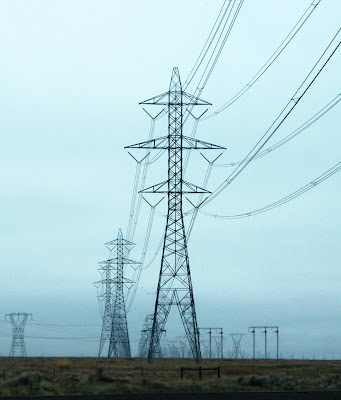
500 kV lattice steel tower
 I-84 Transmission Corridor along the Columbia River
It's a timing issue. The blueprints and, in many cases, the authority don't exist to . . . build a sprawling web of power lines to create a truly national electric grid. "Before you spend billions of dollars on new lines, you have to spend millions of dollars on design work . . . "
The United States now uses a series of regional power grids that make it impossible for a wind farm in Texas to send electricity to a skyscraper in New York. Advocates say that could change under a vastly expanded national grid, opening markets for wind, solar and other energy alternatives. . .
. . . Obama's Energy secretary nominee, Nobel Prize-winning physicist Steven Chu . . . acknowledged the biggest obstacle: determining where to put those power lines. States, municipalities and landowners have protested plans to string transmission networks through their backyards. . .
"Getting approval to build renewable-energy transmission to bring wind and solar to market from remote areas is something where states have an interest and landowners have an interest," said Reid Detchon, executive director of the Energy Future Coalition in Washington, who has pushed for grid upgrades in the stimulus plan. "You're not going to see big transmission towers going up overnight."
Advocates haven't given up on major green infrastructure investments from Congress even if they don't make the stimulus package. Grid expansion -- and regulations easing its way -- could wind up in a comprehensive energy bill this year. . . Several environmentalists say they expect the stimulus package to include up to $2 billion for smart-grid (wind and solar) technology. . .
http://www.latimes.com/news/science/environment/la-na-obama-energy-stimulus16-2009jan16,0,46026.story
Tuesday, January 20, 2009
"Preapproved ratemaking"
I came across several interesting items, including an informative article from late December on the ino.com market information website. A few quotes:
(AP:BOISE, Idaho) Gov. C.L. "Butch" Otter wants to make it cheaper and easier for Idaho Power Co. and other utilities to add billions of dollars of transmission lines and power plants, drawing concern from regulators and large electricity users. . .
"Preapproved ratemaking" will reassure credit analysts and lenders that utilities such as Idaho Power and PacifiCorp will successfully recover the cost of investments such as Gateway West, a 1,200-mile, more than $2 billion power line through Wyoming, Idaho and Oregon scheduled for completion by 2012, (Paul) Kjellander (Otter's energy czar) said. . .
Otter also could issue an executive order requiring state agencies such as the Department of Fish and Game, Transportation Department and Department of Lands to give transmission with "priority attention."
Idaho Power, which backs the legislation, would not comment. . .
Moody's Investors Service and Standard & Poor's have lowered Idaho Power's credit ratings over the last eight years to levels just above those that typically denote speculative, or "junk" debt.
Idaho Power Chief Executive Officer J. LaMont Keen recently complained about the lower credit rating and higher capital costs in the face of needs for infrastructure investment. . .
"This is not something that should be willingly surrendered by the commission in an attempt to assist a transmission or power utility in enhancing its Wall Street credit rating," (PUC Commissioner Jim) Kempton wrote in an e-mail to Kjellander that was obtained by AP through a public records request. "The commission is in unanimous agreement on this point."
Commissioners maintain they've already undertaken steps to help utilities recover investment costs more quickly, including the Idaho Power rate case.
You can read the entire article at http://news.ino.com/headlines/?newsid=689596917790
A companion story in the Idaho Business Review, "Idaho Power rate case gets technical, public hearing," can be found at http://www.idahobusiness.net/archive.htm/2008/12/22/Idaho-Power-rate-case-gets-technical-public-hearing
Plus some interesting quotes from page 3 and 4 of the "Idaho to Oregon Project" planning document from September 7, 2007: http://www.oatioasis.com/IPCO/IPCOdocs/Regional_Planning_Review_Group_Meeting_Notes.pdf
Q: Is there any ROW in place for the 500 kV lines?
A: We are working on the ROW now.
Q: Is Sand Hollow part of the Treasure Valley 500 kV loop?
A: Yes. It will start as a series capacitor and reactor station. Eventually, 500 kV will be built across the northern part of the Treasure Valley to fill out the loop.
No Entry Signs, & Idaho Coordinator
The following people have vinyl No Entry signs if you are interested in buying any for $5:
Evelyn Sayers, Pat Trenkel, Melda Schiemer, Eric White, Rod Price, Patricia Bashaw, Rick Mendiva, Bruce Corn and Tom Phillips. Thanks to all these people for taking this on.
 Bruce Penn has graciously agreed to coordinate the interested parties in Canyon, Owyhee, Payette and Gem counties to keep them informed of what is happening here and help us know what their concerns are as well.
Monday, January 19, 2009
Address for Donations
I'm happy to honor the request to post the address for making donations (especially for our attorney Tom Nelson):
Grant Kitamura, Treasurer
Stop Idaho Power
P.O. Box 9
Ontario, OR 97914
Make out the checks to "Stop Idaho Power." Thanks so much!
Grant Kitamura, Treasurer
Stop Idaho Power
P.O. Box 9
Ontario, OR 97914
Make out the checks to "Stop Idaho Power." Thanks so much!
Town Hall Comments Part 2
More comments from January 9th's Town Hall meeting with Ted Ferrioli:
Renae Corn said, “Our state is so concerned with endangered species that we’ve neglected to take care of our own species.” Donna Kemble thought that she would have herself declared an endangered sage grouse so no line could come within two miles of her. Jim and Jill Conant mentioned where we can’t get flood insurance because we’re a flood plain, so why put metal towers in a flood plain?
Renae Corn said, “Our state is so concerned with endangered species that we’ve neglected to take care of our own species.” Donna Kemble thought that she would have herself declared an endangered sage grouse so no line could come within two miles of her. Jim and Jill Conant mentioned where we can’t get flood insurance because we’re a flood plain, so why put metal towers in a flood plain?
Oregon State Senator Ted Ferrioli, R-John Day

Nancy Peterman from Baker City has a ranch near the Interpretive Center and under the planned corridor She described how two nurses come from Portland with electrically sensitive equipment to treat critically ill people in their cabin clinic. She phoned Adam Bless of the Oregon Department of Energy and told him of her plight. Diane Bloomer of Durkee helped inform the Department of Energy about the farming taking place there.
Jay Chamberlin, Owyhee Irrigation District, restated OID’s support of SIP’s effort. The Bureau of Reclamation, which controls what goes over canals, did not receive any notice about the proposal. Chamberlin was concerned about the “4 ½ miles of the Owyhee siphon (along with other metal conductors such as wheel lines, hand lines and center pivots) which will be subject to electrolysis and corrosion” due to electrical induction. The transmission lines are planning to cross the Snake River in three places, including Starvation Camp near Old Fort Boise on the Oregon Trail and wild species habitat. (See "Useful Links" for more information on Starvation Camp.)
Jean Findley, formerly of the BLM, brought up the problem when spray planes can’t aerially apply herbicides and pesticides, leaving “pockets of vectors that will not be killed. The bottom line is that it’s not just narrow agricultural, it will be large swaths through our little valley.” Field burning, another way to control vectors, will “not be happening” around electrical towers.
Thanks for everyone who made comments and to Senator Ferrioli for giving us a forum to express them.
Sunday, January 18, 2009
Signs & Petitions
We got 1065 signatures counted on our petitions to Idaho Power Company asking them to reroute the transmission lines. Good work everyone!
The No Entry signs are in, and ready to be posted. If you want to buy one or more for $5, Evelyn Sayers west of Ontario has them now. If you are willing to distribute them from your place of work, please let her know so we can get them into the hands of people throughout Malheur County.
The No Entry signs are in, and ready to be posted. If you want to buy one or more for $5, Evelyn Sayers west of Ontario has them now. If you are willing to distribute them from your place of work, please let her know so we can get them into the hands of people throughout Malheur County.
Friday, January 16, 2009
Town Hall Comments Part 1
At the Town Hall meeting held Friday January 9th, State Senator Ted Ferrioli introduced himself to the crowd and passed a microphone around to hear everyone’s comments. What became clear was that this will affect far more than farming practices and the lives of those living under the transmission lines. “You’re well mannered for people who are so mad,” Ferrioli said.
Land values have already been affected. Rick Mendiva, a barber in Nyssa, has been paying for the past 15 years for a place on
The
Ed McKinney owns County View Golf Course under one of the proposed routes. “I’m done if it comes here,” he said. “I just can’t operate a golf course with big towers there.”
Brent Richardson flies a spray plane in
Bill Lawrence, retiring Vale Mayor said, “What happens to businesses if the Petersons can’t farm and the Kenningtons can’t dairy? What happens to the Coop? The real estate? The schools? It’s the entire county and it’s the cities.” Gary Boer’s property is under one of the alternate routes, but he maintained that “this should not just be not in my back yard, but in nobody’s back yard.”
More easement acreage
Matt Ure, a CAD technician, knows more about figuring acres than I do, so here are his calculations for a 30-mile 250-ft swath out of Malheur County, plus calculations for a 50-mile swath, which may be closer to what Idaho Power wants.
acre [ey-ker]noun 1. a common variable unit of land measure, now equal in the U.S. and Great Britain to 43,560 square feet or 1/640 square mile (4047 square meters).
How many Acres of EFU lands in Malheur County?
Below is how I calculated the total acres of EFU lands eaten up by I.P.’s 250 foot easement over 30 miles of Malheur County adversely affected if it should be built:
30 miles x 5,280 feet = 158,400 feet in length 158,400 feet x 250 ft wide = 39,600,000 sq.ft.One acre of land is = to 43,560 sq.ft.
Therefore . . . 39,600,000 sq.ft. / 43,560 sq.ft. = 909.1 acres of easement Idaho Power wants from Malheur County.That translates to 1.15 acres per 200 ft.
50 miles x 5,280 ft. = 264,000 ft.264,000 ft. x 250 ft. easement = 66,000,000 sq.ft.66,000,000 sq.ft. / 43,560 = 1,515.15 total acres of EFU lands taken out of ag. production for a 250 l.ft. power line easement.
Wednesday, January 14, 2009
Jon Beal, Malheur County Planner
Good afternoon Patty,
I have attached a copy of a letter sent to Idaho Power, DOE, the Department of Agriculture and several other interested parties. Statewide Planning Goal 3, Agricultural Lands, identifies agricultural land in eastern Oregon as soils of predominantly NRCS capability classifications I through VI. The majority of the proposed route in Malheur County is located on class I through III soils, much of which is also classed as high value and prime farmlands by Oregon DOA.
Policies contained in the county comprehensive plan create a hierarchy of site preference to soils with a lower capabilty classification for both permitted outright and conditional non-farm uses in the resource (EFU & ERU) zones. They also require normal farming and ranching practices be allowed to exist and continue without interference from non-farm uses. ORS 215.275 requires Idaho Power to address alternative routes. However this statute has been interpreted by the courts to be alternatives to locating in EFU lands and not to alternative routes within EFU lands.
The Planning Department contends the requirements of ORS 215.275(5) and the county comprehensive plan Goal 3 policies require Idaho Power to consider alternative routes within the EFU zone to minimize the impact to EFU and intensively farmed land in the county. We also feel the Hemingway-Sand Hollow direct route located entirely in Idaho is a valid alternative to locating the route on EFU lands in Oregon and must be considered as an alternative pursuant to ORS 215.275.
I want to thank the SIP board and the citizens involved with SIP for their work. Farming is our life line in Malheur County. When I was growing up I spent many Sunday afternoons driving the farm roads in this area with my father who was involved in the field seed business. An afternoon drive never passed without him emphasizing the importance of farmland and farming to our lifestyle in this area. When I was first shown the proposed route just prior to it being made public, I was very concerned there might not be an organized opposition to it. This concern was certainly unfounded. Thanks again for SIP's efforts.
Jon Beal, Malheur County Planning Director
Jon Beal's letter to Eric Hackett of Idaho Power (download HERE):
Dear Mr. Hackett:
The statewide planning goals adopted by LCDC establish broad polices for land use planning in Oregon.
ORS 197.225 - 197.250. Goal 3, Agricultural Lands, aspires to preserve and maintain agricultural land in Oregon. Local comprehensive plans and land use regulations implement these policies. To issue a site certificate, EFSC must find the proposed facility complies with the statewide planning goals and the substantive criteria from local regulations.
OAR 345-022-0030. Agricultural land in eastern Oregon is identified as land classified by the Natural Resources Conservation Service (NRCS) as having predominate soils with a capability classification of I through VI.
OAR 660-033-0020. I have attached maps of the proposed B2H transmission line showing NRCS soil capability classifications I through III for properties located within the corridor including enlarged maps of the “Big Bend,” “Adrian,” “Nyssa” and “Malheur Butte” areas. These areas were included in the Malheur County Soil Survey completed in 1980. I have included an aerial photograph of the area north of Malheur Butte, “ the Larsen property,” that is also included in the proposed corridor. This area was not included in the county soils survey. However, the aerial photographs of the area indicate it is irrigated and intensively farmed. The owner of the property has had a soil survey done on portions the property and this information will be sent to you when the county receives and maps it.
Compliance with the county’s substantive criteria and DLCD’s land use goals and administrative rules is required to receive EFSC site approval. Malheur County’s acknowledged comprehensive plan and zoning regulations implement the state land use regulations. The following four policies are contained in the Malheur County Comprehensive Plan, Goal 3, Agricultural Lands, policies and should be addressed in the selection of the route:
1. Public and private land classified by the U.S. Soils Conservation Service (now Natural Resource Conservation Service, NRCS) as being in Capability Classes I through VI, as well as any other lands determined to be suitable and needed for farm use, are considered to be agricultural lands.
This policy required the designation of exclusive farm use zones in Malheur County in conformance with the Statewide Planning Goal 3, state statutes and administrative rules.
2. Whenever possible, lands having the highest agricultural capabilities will be given the greatest protection (Class I has the highest capability; Class VI has the least).
This policy creates a hierarchy of site preference given to soils of lower soil capability classification for outright and permitted non-farm uses allowed in an EFU zone. Those portions of the route shown on the attached maps are located on class I to III soils, much of which is also classified as prime or high value soils by the Oregon Department of Agricultural.
8. The county will work closely with the irrigation and drainage districts when land use decisions affect the distribution of water for irrigation purposes.
This policy requires the county to address the effect of land use decisions on irrigation and drainage facilities. The location of the transmission line on irrigated lands in intensive farm use will possibly have a negative effect on flood and pivot sprinkler irrigation practices and facilities.
12. Normal farming and ranching activities will be allowed to exist and continue without interference from non-farm uses of the land.
This policy allows normal farming practices to exist without interference from the establishment of non-farm uses allowed in the EFU zone. The proposed location of the transmission line in the EFU zone in the more intensively farmed areas will have a negative effect on irrigation practices, aerial application of chemicals, the tilling of the farmland and the loss of highly productive farmland.
The B2H transmission line is being processed as a utility facility necessary for public service. ORS 215.283(1)(d). ORS 215.275(2) requires the applicant to consider reasonable alternatives to locating the facility in an EFU zone or establish that one of the statutory factors set forth in subsection (2) requires them to locate the facility in an EFU zone. Malheur County requests the following alternative routes be reviewed:
1. Hemingway to Sand Hollow route located entirely in Idaho.
2. Hemingway to Grassy Mountain on the existing 500kv line and then north to Huntington Junction.
3. Hemingway to Grassy Mountain on the existing 500kv line to Buchanan and north to the I-84 corridor.
These proposed alternative routes are located predominantly on federal land and land zoned Exclusive Range Use (ERU). The legislature used a broad brush in its choice of words in describing alternatives that must be considered under ORS 215.275(2). See Friends of Parrett Mountain v. Northwest Natural Gas. Selection of any one of these routes would have considerably less adverse impact on lands in Malheur County zoned EFU and intensively farmed. The location of the facility on intensively farmed land and land with NRCS capability classification I through III, as those shown on the attached maps, will have a negative effect and could significantly alter and possibly increase the cost of typical farming practices in the immediate area of the transmission line. It will interfere with best farming practices including aerial application of chemicals, tilling practices, sprinkler and pivot irrigation facilities and lower dairy cow productivity along with taking high value farmland out of production.
The statutory criteria set forth in ORS 215.275 require the applicant to demonstrate it has considered reasonable alternatives to placement in a resource zone. The alternative analysis required by ORS 215.275 is an analysis of alternatives to the use of EFU lands and does not require analysis of alternative corridors within the EFU zone. However, ORS 215.275(5) requires the county governing body to impose clear and objective conditions on an application for a utility facility siting under ORS 215.281(1)(d) to mitigate and minimize the impact of the facility on surrounding lands devoted to farm use in order to prevent a significant change in accepted farming practices or significantly increase the cost of farm practices on surrounding lands.
This requirement is implemented by Malheur County through the above referenced Goal 3 comprehensive plan policies which require soils having the highest agricultural capabilities be given the greatest protection when establishing outright permitted or conditional non-farm uses in an EFU zone and requires normal farming practices to continue without interference from non-farm uses. The statute assumes some impact on EFU land is permissible and construes the terms “mitigate” and “minimize” together to require a general reduction in the intensity and frequency of an impact. See Friends of Parrett Mountain v. Northwest Natural Gas. Location of the transmission line on soils of lesser agricultural capability that are not intensively farmed and on federal lands would reduce the adverse impact on lands zoned EFU in conformance with state statute and county comprehensive plan policies.
Malheur County reserves the right to submit additional comments and information for consideration when it becomes available to the county. Thank you for your consideration.
Yours truly;
Jon D. Beal
Planning Director
The Board of Directors of Stop Idaho Power wants to thank Jon Beal for this clearly written, well-reasoned and researched letter in behalf of Malheur County and its residents.
Tuesday, January 13, 2009
From Adam Bless, ODOE
Questions answered in four emails about Idaho Power's NOI (Notice of Intent) and the Project Order to be issued by Adam Bless of the Oregon Department of Energy: UPDATED (5) below
(1) rogerfindley@q.com> 01/12/09 7:10 AM
Adam:
Stop Idaho Power has heard that ODOE has issued a Project Order to Idaho Power for the B2H line. What was the date for that, and how do we get a copy of the Project Order? Did ODOE define the impact analysis area? What is it? Have the other alternatives been incorporated in the impact analysis areas?
Thanks for your help.
Roger
(2) Date: Mon, 12 Jan 2009 08:46:24 -0800> From: Adam.Bless@state.or.us> To: rogerfindley@q.com Subject: Re: B2H Project Order to IPCo? Stop Idaho Power
Roger,
ODOE has not yet issued the Project Order. I have drafted the Project Order, but our Attorney General had quite a few comments, which I am now incorporating. I do hope to issue it in the next week, but I can't be certain. The draft project order does have analysis areas for the various standards. There isn't a single analysis area; actually we set a different analysis area for each type of impact.
My draft Project Order does direct Idaho Power to seriously consider several alternative routes. Three of those routes are the three in your earlier letter, particularly the one straight from Hemingway to Sand Hollow through Canyon County. The arguments made by SIP and John Beal in favor of going straight through Idaho were quite convincing, at least to me. Other people further West suggested route changes in their counties as well, and the draft project order directs Idaho Power to consider them also.
I was concerned when I received a letter asking ODOE to not issue a Project Order. I hope people understand that a Project Order is not an approval of anything; it's more like a summary of the comments and issues. Its purpose is to set the expectations for the applicant, not to approve or deny anything. It's similar to the scoping report that BLM must put out. I think you will see that when we issue it. As you have probably noticed, BLM is also taking more time to issue the scoping report than they originally planned.
Please rest assured that when we do issue the Project Order, we'll post it so everyone can see it.
Also, remember that the Project Order is a living document and we can change it anytime if there's a need to do that.
Sorry this is taking so long.
Adam
(3) <rogerfindley@q.com> 01/13/09 7:12 AM
Thanks for the reply, Adam.
According to the EFSC process on the bubble-bar chart given to citizens at the scoping meeting, the Project Order "defines the impact analysis areas." SIP assumes that those are on-the-ground areas where impacts will occur and where those impacts will be analyzed.
When EFU-zoned land is to be impacted, at least one viable alternative must be considered outside of EFU land. Idaho Power has not indicated that any additional routes will be considered for analysis that bypass EFU land in Malheur County. It appears to SIP that the Notice of Intent was incomplete and needs to be revised and resubmitted with addition of at least one alternative route outside of EFU land in Malheur County before the Project Order can be issued and the impact analysis areas defined.
SIP does not believe Idaho Power is serious about considering routes bypassing EFU land in Malheur County based on recent information we have learned that they (Idaho Power) are now planning to place their substation on private land in Idaho nearer to Adrian, Oregon, rather than on BLM land near Sand Hollow in Idaho. The 'sleeping giant' in Idaho is waking, and citizens' groups there are forming to keep this line out of their farm ground and away from their homes as well. SIP believes Idaho Power still thinks it will be easier, and less deadly to their public relations in Idaho, to deal with the farmers/residents in Malheur County and condemn their land than to deal with the farmers/residents in Idaho or with the environmental groups on public land.
SIP's alternative #2, which bypasses all EFU land in Malheur County and all farmland in Idaho, needs to be analyzed as part of the NEPA process and needs to be a serious contender for routing of this line if the 'loop' around Treasure Valley as proposed in the Treasure Valley Electric Plan, which in no way was a plan representative of the citizens to be affected, ultimately is to be built.
One final question: are there any legal requirements by the state of Oregon regarding the ways and means by which Idaho Power (or any utility proposing a project with major impacts to private landowners) must inform individuals about the impending line, particularly those directly under the line? More and more individuals are coming forward to say that they are just now learning about this line for the first time. Does the scoping process need to be restarted so that all interested parties can have a chance to participate and comment?
Thanks again for your help.
Roger
(4) Date: Tue, 13 Jan 2009 15:22:38 -0800> From: Adam.Bless@state.or.us> To: rogerfindley@q.com> CC: Tom.Stoops@state.or.us Subject: RE: B2H Project Order to IPCo? Stop Idaho Power
Roger,
You have asked some questions about the EFSC process, the NOI, and the Project Order.
The Project Order does several things, and one of the most important sections of the Project Order is the section that shows the analysis areas. Those are the areas where impacts must be analyzed. We often set the analysis areas a little larger than the actual impact, to create a buffer zone. For example, for endangered species ODFW usually recommends an analysis area that extends a few hundred feet beyond the area where there will be physical impacts.
Different types of impacts have different analysis areas. For instance - for Cultural resources we usually specify an analysis area that covers the site but does not go beyond it. On the other hand, for scenic impacts we usually specify an analysis area that is much wider than the proposed corridor. The amount depends on the type of facility, because some facilities are more visible than others.
I agree that Idaho Power's EFSC NOI should include at least one viable alternative or reasons why only one route was feasible. The rules do not say whether the alternatives must be completely different routes or if they can be short "detours" like the ones that show up as green lines on the map in the NOI. In any case, the Project Order is the document where we direct Idaho Power to consider other alternatives beyond what they offered in the NOI.
You have not yet seen the draft Project Order, but it does tell Idaho Power to consider specific alternatives. The three alternatives shown in the map you sent with your written comments are listed in the Project Order as alternatives that must be seriously considered. I agree that your Alternative #2 must be considered. However, I do have a question for you about alternative 2: - does it inadvertenty affect Durkee? It looks from the map like alternative 2 heads right for Durkee. I have received much correspondence from folks in Durkee, especially Diane Bloomer. As you can understand, ODOE's efforts to help one community should not come at the expense of a different community.
I also agree that for EFU land, IPC must show that "reasonable alternatives have been considered" and can only be rejected if those non-EFU alternatives are shown to be unfeasible under the criteria in section 2 of 215.275. The application is where they must do this. Our draft Project Order makes this very clear. So even though the NOI didn't include the alternatives analysis set forth in ORS 215.275 , the application will have to.
In my draft Project Order I have taken the position that Idaho Power must treat farm land in Idaho as a serious alternative to EFU land in Oregon, because Idaho does not prohibit residential development on farm land as Oregon does. I based that position mostly on comments from John Beal but I think it's consistent with SIP's position. I have asked our Attorney General to confirm this position. I realize there will be pushback from Idaho. BLM forwarded to us a letter from the city of Parma, protesting the placement of the powerline near an area where they expect some urban growth. In ODOE's opinion, that expectation is not sufficient to meet the test of ORS 215.275.
There was a time when ODOE could deem the NOI incomplete and refuse to process it further until it was "complete". In fact we used to issue "RAI's" (Request for Additional Information) on NOI's. But in 1993 the legislature changed the focus of the NOI and removed ODOE's authority to deem an NOI "complete" or "incomplete". In retrospect I believe they made a good decision, although you may disagree. The principle was that the NOI was never intended to be a decision making document. It's a "heads up", nothing more. Its purpose is to get people's attention, identify problems and generate comments from the public and from our fellow reviewing agencies. We have received hundreds of comments which identify many issues, so I would say the NOI did its job. But remember, the NOI is not a decision making document and does not result in the approval or denial of anything.
Based on the response to the NOI, we will direct Idaho Power to consider alternatives that were not in their original NOI. I think that's consistent with what you're asking. For that reason, I think it's important that we do issue the Project Order. It's legally required, and it's the right thing to do. The Project Order is the document where we point out the problems in Idaho Power's original plan, direct them to look at alternatives and provide our expectations regarding the Application. In short, the Project Order is where we give some regulatory significance to the issues raised in comment.
Thank you for the heads up about any possible new plans to change the substation. I speak regularly with both Eric and Lucas and neither of them has mentioned that. As recently as a week ago Eric told me on the phone that they are still planning the Sand Hollow substation. Also thank you for the heads up about citizen's groups in Idaho. We need to reach a compromise that both states can agree on. Otherwise we risk Federal preemption. No one wins if that happens.
Finally, you asked about the notice requirements. Those requirements are found at OAR 345-015-0110, which in turn refers to the list of adjacent property owners described at OAR 345-020-0011. In plain English, it's very similar to land use law - it requires notice to owners of property within 500 feet of the proposed corridor. The rule requires Idaho Power to get those names from the county property tax assessor's most recent roll. Certainly that would include people right under the line.
However, Idaho Power will likely change the route in response to the comments. When they submit the Application for Site Certificate, it might show a route that is quite different from the one shown in the NOI. We would consider that a valid response to the public suggestions. If that happens, it does not start the process all over again. If it did, that would create an infinite loop from which there would be no escape. The people who own property adjacent to the proposed corridor in the application will receive notice of the application, and will have ample opportunity to participate and comment.
Feel free to write of call at anytime.
Adam
(5) 1-14-2009UPDATE
Thanks, Adam, for your thorough reply. We surely appreciate all the time and attention you are giving us on this important county issue.
A point of clarification: our Alternative #2 is meant to basically END at the Malheur County line. Idaho Power's TVEP shows a loop around the larger Treasure Valley; hence, the line would go to the east behind Farewell Bend and Weiser, but we propose it goes north at whatever would be a good route for the Durkee folks.
From information received from the electrical people we are working with, we understand that only a switching station is necessary when a line splits (one leg to the north, one to the west). We would be happy to sit down with BLM, Idaho Power, and anyone from Durkee/Baker County to put the route at the north end of Malheur County that would best meet the needs of the Durkee farmers, other folks in Baker County, Idaho Power, and sage grouse, which is the only resource of a highly controversial nature in that part of the world at the Malheur/Baker County line (I was the Range Conservationist for that country for a number of years, as well as botanist for the Vale District BLM).
SIP tried to make it clear that our proposed Alternative #2 route is a 2-3 mile CORRIDOR, with considerable flexibility for exact route location. There are many options for exact locations from Vines Hill on Highway 20 to the north that completely miss EFU land in Malheur County, which is of course our goal.
Jean
(1) rogerfindley@q.com> 01/12/09 7:10 AM
Adam:
Stop Idaho Power has heard that ODOE has issued a Project Order to Idaho Power for the B2H line. What was the date for that, and how do we get a copy of the Project Order? Did ODOE define the impact analysis area? What is it? Have the other alternatives been incorporated in the impact analysis areas?
Thanks for your help.
Roger
(2) Date: Mon, 12 Jan 2009 08:46:24 -0800> From: Adam.Bless@state.or.us> To: rogerfindley@q.com Subject: Re: B2H Project Order to IPCo? Stop Idaho Power
Roger,
ODOE has not yet issued the Project Order. I have drafted the Project Order, but our Attorney General had quite a few comments, which I am now incorporating. I do hope to issue it in the next week, but I can't be certain. The draft project order does have analysis areas for the various standards. There isn't a single analysis area; actually we set a different analysis area for each type of impact.
My draft Project Order does direct Idaho Power to seriously consider several alternative routes. Three of those routes are the three in your earlier letter, particularly the one straight from Hemingway to Sand Hollow through Canyon County. The arguments made by SIP and John Beal in favor of going straight through Idaho were quite convincing, at least to me. Other people further West suggested route changes in their counties as well, and the draft project order directs Idaho Power to consider them also.
I was concerned when I received a letter asking ODOE to not issue a Project Order. I hope people understand that a Project Order is not an approval of anything; it's more like a summary of the comments and issues. Its purpose is to set the expectations for the applicant, not to approve or deny anything. It's similar to the scoping report that BLM must put out. I think you will see that when we issue it. As you have probably noticed, BLM is also taking more time to issue the scoping report than they originally planned.
Please rest assured that when we do issue the Project Order, we'll post it so everyone can see it.
Also, remember that the Project Order is a living document and we can change it anytime if there's a need to do that.
Sorry this is taking so long.
Adam
(3) <rogerfindley@q.com> 01/13/09 7:12 AM
Thanks for the reply, Adam.
According to the EFSC process on the bubble-bar chart given to citizens at the scoping meeting, the Project Order "defines the impact analysis areas." SIP assumes that those are on-the-ground areas where impacts will occur and where those impacts will be analyzed.
When EFU-zoned land is to be impacted, at least one viable alternative must be considered outside of EFU land. Idaho Power has not indicated that any additional routes will be considered for analysis that bypass EFU land in Malheur County. It appears to SIP that the Notice of Intent was incomplete and needs to be revised and resubmitted with addition of at least one alternative route outside of EFU land in Malheur County before the Project Order can be issued and the impact analysis areas defined.
SIP does not believe Idaho Power is serious about considering routes bypassing EFU land in Malheur County based on recent information we have learned that they (Idaho Power) are now planning to place their substation on private land in Idaho nearer to Adrian, Oregon, rather than on BLM land near Sand Hollow in Idaho. The 'sleeping giant' in Idaho is waking, and citizens' groups there are forming to keep this line out of their farm ground and away from their homes as well. SIP believes Idaho Power still thinks it will be easier, and less deadly to their public relations in Idaho, to deal with the farmers/residents in Malheur County and condemn their land than to deal with the farmers/residents in Idaho or with the environmental groups on public land.
SIP's alternative #2, which bypasses all EFU land in Malheur County and all farmland in Idaho, needs to be analyzed as part of the NEPA process and needs to be a serious contender for routing of this line if the 'loop' around Treasure Valley as proposed in the Treasure Valley Electric Plan, which in no way was a plan representative of the citizens to be affected, ultimately is to be built.
One final question: are there any legal requirements by the state of Oregon regarding the ways and means by which Idaho Power (or any utility proposing a project with major impacts to private landowners) must inform individuals about the impending line, particularly those directly under the line? More and more individuals are coming forward to say that they are just now learning about this line for the first time. Does the scoping process need to be restarted so that all interested parties can have a chance to participate and comment?
Thanks again for your help.
Roger
(4) Date: Tue, 13 Jan 2009 15:22:38 -0800> From: Adam.Bless@state.or.us> To: rogerfindley@q.com> CC: Tom.Stoops@state.or.us Subject: RE: B2H Project Order to IPCo? Stop Idaho Power
Roger,
You have asked some questions about the EFSC process, the NOI, and the Project Order.
The Project Order does several things, and one of the most important sections of the Project Order is the section that shows the analysis areas. Those are the areas where impacts must be analyzed. We often set the analysis areas a little larger than the actual impact, to create a buffer zone. For example, for endangered species ODFW usually recommends an analysis area that extends a few hundred feet beyond the area where there will be physical impacts.
Different types of impacts have different analysis areas. For instance - for Cultural resources we usually specify an analysis area that covers the site but does not go beyond it. On the other hand, for scenic impacts we usually specify an analysis area that is much wider than the proposed corridor. The amount depends on the type of facility, because some facilities are more visible than others.
I agree that Idaho Power's EFSC NOI should include at least one viable alternative or reasons why only one route was feasible. The rules do not say whether the alternatives must be completely different routes or if they can be short "detours" like the ones that show up as green lines on the map in the NOI. In any case, the Project Order is the document where we direct Idaho Power to consider other alternatives beyond what they offered in the NOI.
You have not yet seen the draft Project Order, but it does tell Idaho Power to consider specific alternatives. The three alternatives shown in the map you sent with your written comments are listed in the Project Order as alternatives that must be seriously considered. I agree that your Alternative #2 must be considered. However, I do have a question for you about alternative 2: - does it inadvertenty affect Durkee? It looks from the map like alternative 2 heads right for Durkee. I have received much correspondence from folks in Durkee, especially Diane Bloomer. As you can understand, ODOE's efforts to help one community should not come at the expense of a different community.
I also agree that for EFU land, IPC must show that "reasonable alternatives have been considered" and can only be rejected if those non-EFU alternatives are shown to be unfeasible under the criteria in section 2 of 215.275. The application is where they must do this. Our draft Project Order makes this very clear. So even though the NOI didn't include the alternatives analysis set forth in ORS 215.275 , the application will have to.
In my draft Project Order I have taken the position that Idaho Power must treat farm land in Idaho as a serious alternative to EFU land in Oregon, because Idaho does not prohibit residential development on farm land as Oregon does. I based that position mostly on comments from John Beal but I think it's consistent with SIP's position. I have asked our Attorney General to confirm this position. I realize there will be pushback from Idaho. BLM forwarded to us a letter from the city of Parma, protesting the placement of the powerline near an area where they expect some urban growth. In ODOE's opinion, that expectation is not sufficient to meet the test of ORS 215.275.
There was a time when ODOE could deem the NOI incomplete and refuse to process it further until it was "complete". In fact we used to issue "RAI's" (Request for Additional Information) on NOI's. But in 1993 the legislature changed the focus of the NOI and removed ODOE's authority to deem an NOI "complete" or "incomplete". In retrospect I believe they made a good decision, although you may disagree. The principle was that the NOI was never intended to be a decision making document. It's a "heads up", nothing more. Its purpose is to get people's attention, identify problems and generate comments from the public and from our fellow reviewing agencies. We have received hundreds of comments which identify many issues, so I would say the NOI did its job. But remember, the NOI is not a decision making document and does not result in the approval or denial of anything.
Based on the response to the NOI, we will direct Idaho Power to consider alternatives that were not in their original NOI. I think that's consistent with what you're asking. For that reason, I think it's important that we do issue the Project Order. It's legally required, and it's the right thing to do. The Project Order is the document where we point out the problems in Idaho Power's original plan, direct them to look at alternatives and provide our expectations regarding the Application. In short, the Project Order is where we give some regulatory significance to the issues raised in comment.
Thank you for the heads up about any possible new plans to change the substation. I speak regularly with both Eric and Lucas and neither of them has mentioned that. As recently as a week ago Eric told me on the phone that they are still planning the Sand Hollow substation. Also thank you for the heads up about citizen's groups in Idaho. We need to reach a compromise that both states can agree on. Otherwise we risk Federal preemption. No one wins if that happens.
Finally, you asked about the notice requirements. Those requirements are found at OAR 345-015-0110, which in turn refers to the list of adjacent property owners described at OAR 345-020-0011. In plain English, it's very similar to land use law - it requires notice to owners of property within 500 feet of the proposed corridor. The rule requires Idaho Power to get those names from the county property tax assessor's most recent roll. Certainly that would include people right under the line.
However, Idaho Power will likely change the route in response to the comments. When they submit the Application for Site Certificate, it might show a route that is quite different from the one shown in the NOI. We would consider that a valid response to the public suggestions. If that happens, it does not start the process all over again. If it did, that would create an infinite loop from which there would be no escape. The people who own property adjacent to the proposed corridor in the application will receive notice of the application, and will have ample opportunity to participate and comment.
Feel free to write of call at anytime.
Adam
(5) 1-14-2009
Thanks, Adam, for your thorough reply. We surely appreciate all the time and attention you are giving us on this important county issue.
A point of clarification: our Alternative #2 is meant to basically END at the Malheur County line. Idaho Power's TVEP shows a loop around the larger Treasure Valley; hence, the line would go to the east behind Farewell Bend and Weiser, but we propose it goes north at whatever would be a good route for the Durkee folks.
From information received from the electrical people we are working with, we understand that only a switching station is necessary when a line splits (one leg to the north, one to the west). We would be happy to sit down with BLM, Idaho Power, and anyone from Durkee/Baker County to put the route at the north end of Malheur County that would best meet the needs of the Durkee farmers, other folks in Baker County, Idaho Power, and sage grouse, which is the only resource of a highly controversial nature in that part of the world at the Malheur/Baker County line (I was the Range Conservationist for that country for a number of years, as well as botanist for the Vale District BLM).
SIP tried to make it clear that our proposed Alternative #2 route is a 2-3 mile CORRIDOR, with considerable flexibility for exact route location. There are many options for exact locations from Vines Hill on Highway 20 to the north that completely miss EFU land in Malheur County, which is of course our goal.
Jean
Monday, January 12, 2009
"I'm Exceedingly Impressed"
 Gary Pearson, Tom Nelson, Jean Findley and Cliff Looney at Bob's Steakhouse in Nyssa
 "I'm exceedingly impressed in how far you've gotten in such a short time." Tom Nelson, Utility, Energy and Condemnation Law, began his remarks to well over 400 people in FRCC's Snake River Room Monday night by noting that things could be worse: Idaho Power is one of those companies that is still interested in what their customers think.
 He expressed the desire to save everyone a lot of grief and expense by having our group convince Idaho Power move the transmission line without going to court. "They didn't stop to think about a whole range of issues," he noted, issues such as not inviting residents of all six counties to have input on the siting of the transmission line.
 Bruce Corn & Clinton Kennington overlooking the valley with Tom Nelson
"What you've done so far is excellent," he told the crowd. But when it comes to what happens next, he outlined two paths that will be taken concurrently:
(1) The Federal Environmental Path. National Environmental Policy Act (NEPA) requires that IP file an EIS (Environmental Impact Statement) since they intend to cross Federal land, in this case, 11% of the time. Nelson observed that that IP did not appear to have fully analyzed and evaluated possible alternatives to their chosen corridor.
(2) The State Siting Track. The EFSC (Oregon Energy Facility Siting Council) is a one-stop approval process for determining whether a site certificate (permit to build) should be issued. The hearing is conducted like a court case: "It can be exhausting, time consuming, expensive, and thorough," said Nelson. Anyone with standing can participate. The SIP Board of Directors has already determined that they are willing to go to the expense this process would entail. When all testimony is given in these hearings, Nelson continued, an Administrative Judge will recommend to the EFSC whether a site certificate should be issued for actual construction of the line.
Need for the facility must be proven, something that may now be in question due to the precipitous decline in the economy. If this process actually results in the awarding of a site certificate to IP, they must still go through the condemnation process, which can be litigated by 400 individual landowners in Malheur County and dozens in Owyhee and Baker Counties.
 Nelson stressed several points: First, "how immensely proud you should be of your organizing committee. Your relationship with the County Court is excellent.
"The second point is one of unity. You'll be approached individually. Unity and cohesion are critical. . . If Idaho Power calls and says 'I want to meet with you,' say No Thanks, I don't want to meet. My land is NOT FOR SALE. Tell your neighbors! You'll be way ahead.
"Your ultimate goal isn't to kill transmission capacity. You can have it off to the west and off to the north. . .
"Idaho Power's road is not easy. Malheur County has a lot to say. If I were the folks that work in the top floor in Boise, I wouldn't be sleeping well. You can let them know in a persuasive, professional manner, they blew it when they put (the transmission line) down the middle of the valley. . . You will be most effective by convincing Idaho Power that they don't want to dance in Malheur County. IT WILL BE UGLY."
Questions following Nelson's presentation addressed the support of Owyhee County for the Option 2 line as long as it moves farther away from private land; the condemnation process and how this will not benefit anybody; and the desire of other smaller groups in Parma, Owyhee and Baker to retain Tom Nelson to represent them as well.
Thanks to Ken Teramura for the use of his photographs.
Sunday, January 11, 2009
Senator Ted Ferrioli Visits Malheur County
Senator Ted Ferrioli, Oregon Senate Minority Leader from John Day, toured rural Malheur County and held a Friday evening Town Hall meeting with a crowd of several hundred people representing Ontario, Vale, Nyssa, Adrian, Baker City, Durkee, and Parma.

Above, left to right, Retiring Vale Mayor Bill Lawrence, Malheur County Commissioner Lou Wettstein, and Oregon State Senator Ted Ferrioli, R-John Day
Senator Ferrioli is observant and a quick study and was able to give us some practical and valuable advice on what direction to take in our efforts. He listened to dozens of personal stories at our meeting at the Boulevard Grange. Ferrioli promised to do what he could in Salem to address legislation that would preserve farmland for farming rather than siting utilities, and place human beings on a par with sage grouse.
Stay tuned, I'll be updating this story soon.
Friday, January 9, 2009
"There's No (Center Pivot) Circles There"
It's puzzling to find that some people think that unless we use center pivots, it doesn't count as irrigation. It hardly even counts as agriculture. If it doesn't look like a circle from the air, then we should put a transmission corridor through it.
 There are center pivots in Malheur County, but much of our most productive, intensively cultivated, furrowed fields lend themselves better to row crops such as seed crops, onions and sugarbeets, which do not do very well under center pivots. Pivots are useful on large acreages but that doesn't make the ground more productive than using wheel lines or even solid set sprinklers. One thing for sure, if you are going to want center pivots in the future, don't put transmission lines there first.
 I hope our friends reading this blog recognize that high-value agriculture takes place without necessarily using center pivots. And those are real pictures of a robin and a quail on fenceposts.
Member-in-Standing
Bruce Corn gave the Malheur County Court a letter requesting our non-profit organization be member-in-standing for the bi-weekly conference call with state agencies and Idaho Power regarding the expansion of the energy grid. They accepted our proposal without any debate. The next meeting will be Jan 15th and will include a member of our committee. The Owyhee Irrigation District will also be approaching the Department of Energy and BLM requesting that the OID be reconized as an organization for coordination, which will give us another voice at the table.
Senator Ted Ferrioli arrives in Ontario today for a tour of the affected areas and a Town Hall meeting at the Boulevard Grange tonight at 6:30. He is interested in your feedback to the issues facing our community.
The meeting with Tom Nelson will be Monday night at 7:00 p.m. instead of Tuesday as reported in the Argus.
Thursday, January 8, 2009
Request for Follow-up Meeting
Hello, Roger –
Thanks, again, for the message you recently sent me regarding the status of your proposals for the Boardman to Hemingway Project and a follow-up meeting with “Stop Idaho Power” (SIP).
I spoke with Eric Hackett about this yesterday. He said that he certainly did intend on a follow-up meeting as soon as Idaho Power has new information to share regarding the alternative routes SIP has proposed, as well as more information on the need and reason for the location of the Sand Hollow substation. Please remember that Idaho Power is analyzing the feasibility of your proposals along with a number of others received from the public during the scoping process, and it will take some time. Idaho Power is also expecting to receive a project order from the Oregon Department of Energy within the month and will have to factor those requirements into its analysis.
I understand that is difficult to wait for information when the project is of such great concern to you and your neighbors. Please be assured that your interest is well known and that your concerns will be addressed as soon as possible. Again, Eric is committed to meeting with you once he has information to share. And while Eric is your direct connection to Idaho Power, please continue to feel free to contact me if you have questions about SIP’s opportunities for involvement with the Boardman to Hemingway Project.
Regards,
Susan
Susan Hayman | EnviroIssues
P.O. Box 1096 | Boise ID 83701
Office: 208.385.0128 | Cell: 208.869.2120
shayman@enviroissues.com | www.enviroissues.com
Wednesday, January 7, 2009
2 Important Meetings Coming Up!
(1) Friday, January 9th, 6:30 p.m. at the Boulevard Grange with Oregon State Senator Ted Ferrioli. This will be a Town Hall meeting and the main subject will be the 500 kV transmission line. Senator Ferrioli is interested in meeting local residents, so please stop in.
(2) Monday, January 12th, 7:00 p.m. at the Four Rivers Cultural Center in Ontario. Energy and Utility Law Attorney Tom Nelson will be there to answer your questions. Bring everyone you can to this meeting.
(2) Monday, January 12th, 7:00 p.m. at the Four Rivers Cultural Center in Ontario. Energy and Utility Law Attorney Tom Nelson will be there to answer your questions. Bring everyone you can to this meeting.
- Roger Findley will bring us up to date on what has happened since our last meeting.
- Bring any petitions you may have had signed.
- You can buy vinyl No Entry signs for $5.00 each. Post these everywhere you can.
If you have an interest in the economic future of Malheur County, you need to come to this meeting. "Get Involved Now or Suffer Later."
Parma Impact Task Force
We want to give a welcome to any readers from Parma. The decision to swing wide over Adrian from Sand Hollow means that a big chunk of Parma will be under giant transmission towers when it might have gone straight south to Hemingway and avoided any town locales at all.
The folks from Parma Impact Task Force LLC support our groups' Option 2 that relocates the Sand Hollow substation to north of Payette and makes a circle using designated utility corridors, thus avoiding all privately held property. We've heard from other smaller groups as well, including Baker City's contingent.
If you're from Parma and you're just finding out about how this will impact you, ask around and you'll eventually hear all about it.
Better yet, join us at our meeting Monday, January 12th, at the Four Rivers Cultural Center in Ontario at 7:00. We'll be talking with Energy and Utility Law Attorney Tom Nelson.
See you there!
Tuesday, January 6, 2009
Moving the Sand Hollow Substation
Dennis Hall, Idaho Power electrician and lineman for 25 years, trainer and consultant for linemen, power companies, and electricians, is now a resident of Vale, Oregon. (His Master's degree is not in engineering.)
When asked by our SIP citizens' group about relocating the Sand Hollow substation to north of Payette (see maps below), he said it would work just fine.
 Option 2 relocates the Sand Hollow substation to north of Payette, parallels the PP&L line to Grassy Mountain, then goes north. This route is 46 miles longer than the original loop below. This is the option all those outraged folks in Canyon County who were shut out of the siting process like the best. Download this map with notes HERE or under Map Links at right.
 Original TVEP 500 kV loop, 163 miles around the Treasure Valley plus 42 miles to the Baker County line from Sand Hollow for a total of 205 miles. Download HERE or under Map Links.
In a long conversation with officials of Idaho Power, Dennis Hall asked a number of questions, including why Sand Hollow for a new substation? (no answer) and why not keep the entire loop inside of Idaho? (there was no answer to that, either.)
When Dennis asked why they insist on going right through Malheur County farmland, these Idaho Power Officials said:
When asked by our SIP citizens' group about relocating the Sand Hollow substation to north of Payette (see maps below), he said it would work just fine.
 Option 2 relocates the Sand Hollow substation to north of Payette, parallels the PP&L line to Grassy Mountain, then goes north. This route is 46 miles longer than the original loop below. This is the option all those outraged folks in Canyon County who were shut out of the siting process like the best. Download this map with notes HERE or under Map Links at right.
 Original TVEP 500 kV loop, 163 miles around the Treasure Valley plus 42 miles to the Baker County line from Sand Hollow for a total of 205 miles. Download HERE or under Map Links.
If Idaho Power had used the straight shot from Sand Hollow to Hemingway (37 miles) instead of swinging into Oregon (52 miles) they could have saved 15 miles off their total. It makes us think that it's not the length of the route that's most important, it's what IP perceives as the "path of least resistance."
In a long conversation with officials of Idaho Power, Dennis Hall asked a number of questions, including why Sand Hollow for a new substation? (no answer) and why not keep the entire loop inside of Idaho? (there was no answer to that, either.)
When Dennis asked why they insist on going right through Malheur County farmland, these Idaho Power Officials said:
"We Don't Want Much." (Just 800 acres of prime property and our rural livelihood.)
Dennis compares the locating of a substation to "running an extension cord across your garage." The Sand Hollow substation would serve as a switching point to the Treasure Valley Electrical Plan loop, and could be situated in a number of places.
In case you want to know more about substations, read on. From Idaho Power's Treasure Valley Electrical Plan p. 24-29:
Substations - A substation is used to transform one voltage to another and for protecting and controlling transmission and distribution lines.
What’s inside a substation?– Support structures to terminate transmission lines
Substations - A substation is used to transform one voltage to another and for protecting and controlling transmission and distribution lines.
What’s inside a substation?– Support structures to terminate transmission lines
- Large metallic pipe called bus work
- Circuit breakers
- Switches
- Transformers
Think of a substation as being an onramp or off-ramp from an interstate or an intersection connecting an arterial to a collector road.
- In general, power flows from source substations to hub substations then from hub substations to distribution substations.
- A source substation and hub substation can be co-located.
- then moves down a smaller state highway, leaving the highway at a major intersection (hub substation) onto a city street
- and finally turns off the city street via a minor intersection (distribution substation) into his or her subdivision.
Substation Types
- Source Substation – Acts as the receiving point for energy produced at distant generation.
-Typically 230,000-Volts and higher
-Can be co-located with other types of substations
-Send out power at 230,000-Volts to Hub Substations
-Currently there are 2 Source Substations in the Treasure Valley - Hub Substations – Convert 230,000-Volts (typically) to 138,000-Volts for transmission to Distribution Substations
-Each Hub Substation can have two or more 138,000-Volt transmission lines from it
-3 to 5 distribution substations per line
-Currently there are 4 Hub Substations in the Treasure Valley Substation Types - Distribution Substation – Convert the 138,000-Volt transmission from the Hub Substations to 12,470 or 34,500-Volts for delivery to its end use.
Monday, January 5, 2009
How many acres of land?
Think about how many acres of productive land Idaho Power's 250 foot easement over 30 miles of Malheur County has the potential to adversely affect:
30 miles * 5,280 feet = 158,400 feet in length x 250 ft wide
One acre = 207 ft * 207 feet
Every 200 feet of transmission line traverses one acre of ground
158,400/200 = 792 acres of easement Idaho Power wants from Malheur County.
To quote again: http://arcweb.sos.state.or.us/rules/OARS_600/OAR_660/660_033.html
"(17) A power generation facility shall not preclude (exclude) more than 12 acres from use as a commercial agricultural enterprise unless an exception is taken pursuant to OAR chapter 660, division 4. "
Even if a tenth of this nearly 800 acres is farmland, it's still too much.
Malheur County isn't like Morrow or Umatilla Counties dry land farms; this ground is as intensively farmed and productive in its way as Willamette.
Saturday, January 3, 2009
Meeting Dates
Meeting dates for the next few weeks:
Monday January 5th 7:00 p.m. Board of Directors meeting at Vo-Tech building TVCC
Friday January 9th 6:30 p.m. (UPDATE earlier time) Senator Feriolli Town Hall meeting at the Boulevard Grange. All invited! Please join us and have a talk with Senator Feriolli.
Monday January 12th 7:00 p.m. Monthly meeting at the Four Rivers Cultural Center. Everyone is invited to this one. We'll be talking with Attorney Tom Nelson, Utility and Energy Law. Bring everyone you know. We will be posting the agenda in the near future.
Oregon Ag Policy Part 4
The following Oregon Administrative Rules outline the role of county government in preventing "significant change in accepted farm practices or a significant increase in the cost of farm practices" by imposing "clear and objective conditions" on the siting of these utilities.
OAR 660-033-0010 Division 33 Agricultural Lands
http://arcweb.sos.state.or.us/rules/OARS_600/OAR_660/660_033.html
(you've read this language before in ORS 215.275; especially note paragraph (d) and(17) below)
(16)(a) A utility facility is necessary for public service if the facility must be sited in an exclusive farm use zone in order to provide the service. To demonstrate that a utility facility is necessary, an applicant must show that reasonable alternatives have been considered and that the facility must be sited in an exclusive farm use zone due to one or more of the following factors:
(A) Technical and engineering feasibility;
(B) The proposed facility is locationally dependent. A utility facility is locationally dependent if it must cross land in one or more areas zoned for exclusive farm use in order to achieve a reasonably direct route or to meet unique geographical needs that cannot be satisfied on other lands;
(C) Lack of available urban and nonresource lands;
(D) Availability of existing rights of way;
(E) Public health and safety; and
(F) Other requirements of state and federal agencies.
(b) Costs associated with any of the factors listed in subsection (16)(a) of this rule may be considered, but cost alone may not be the only consideration in determining that a utility facility is necessary for public service. Land costs shall not be included when considering alternative locations for substantially similar utility facilities and the siting of utility facilities that are not substantially similar.
(c) The owner of a utility facility approved under this section shall be responsible for restoring, as nearly as possible, to its former condition any agricultural land and associated improvements that are damaged or otherwise disturbed by the siting, maintenance, repair or reconstruction of the facility. Nothing in this subsection shall prevent the owner of the utility facility from requiring a bond or other security from a contractor or otherwise imposing on a contractor the responsibility for restoration.
(d) The governing body of the county or its designee shall impose clear and objective conditions on an application for utility facility siting to mitigate and minimize the impacts of the proposed facility, if any, on surrounding lands devoted to farm use in order to prevent a significant change in accepted farm practices or a significant increase in the cost of farm practices on surrounding farmlands.
(17) A power generation facility shall not preclude (exclude) more than 12 acres from use as a commercial agricultural enterprise unless an exception is taken pursuant to OAR chapter 660, division 4.
(It seems to me that related distribution facilities (transmission lines) should not take more land (12 acres) out of production than a commercial agricultural enterprise "power generation facility" would under the above OAR.)
If you're confused on what an "energy facility" is, it's because ORS Chapter 469, the State of Oregon refers to both power generation facilities and high voltage transmission lines as "energy facilities": http://www.leg.state.or.us/ors/469.html
(11)(a) “Energy facility” means any of the following:
(A) An electric power generating plant with a nominal electric generating capacity of 25 megawatts or more, including but not limited to:
(i) Thermal power; or
(ii) Combustion turbine power plant.
(B) A nuclear installation as defined in this section.
(C) A high voltage transmission line of more than 10 miles in length with a capacity of 230,000 volts or more to be constructed in more than one city or county in this state. . .
Subscribe to:
Posts (Atom)